Hiking with the Samsung Watch 5 Pro and GPX files.
Certainly frowned upon among real hikers: look for suitable hiking routes using Google Maps or Apple Maps and lay them out. Well, that’s exactly what I did on my hiking holiday on the border with Austria – and I’ll probably never do it again.
How come? Because both Google Maps and Apple Maps gave me and my partner a premature »end in the field«. According to the proprietary mapping services, our trail supposedly continued where cows and horses ate the grass for their lunchtime meal.
The result: We made our way to the destination on our own with the help of directions.
That was day 1.
For the remaining days of hiking, we wanted to focus on reliable routes that would not lead us astray. In our case, we found a welcome solution.
Local website with GPX files for suitable hiking routes
After a quick look at the search engine results, we found the local website, which has numerous hiking trails and GPX files available for free download.
Each of these paths are also provided with appropriate information:
- difficulty of the route
- distance
- Duration on foot (and possibly by bike)
- elevation gain
It all sounded pretty promising and extremely familiar to me.
It doesn’t matter whether it’s a cell phone or a smartwatch: GPX files are easy to use.
My Watch 5 Pro from Samsung is able to use such files, as I described in my field report.
After 7 years of Apple Watch, I now wear a Samsung Smartwatch – my conclusion after 3 months
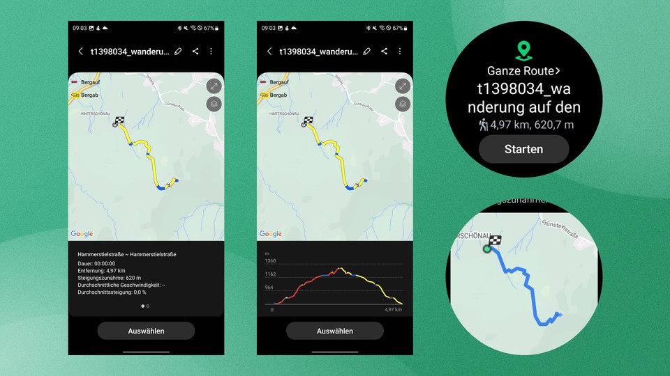
The procedure is very simple. I download the GPX file to my phone and import it into Samsung’s Health app. Other apps like Komoot and Garmin smartwatches (for example) are also able to read the file format.
From there, the smartwatch can access the route and start the hiking route. Routes you have recorded yourself can also be saved and exported in GPX format. So it would be possible for me to share my own discovered paths with other hikers.
I loaded the most promising routes onto my cell phone and smartwatch via the local website. The result speaks for itself: the routes were pretty accurate and kept what the website promised us.
Even more: The hiking trails were visibly worth it and sweetened our hiking holiday.
What are GPX files? GPX stands for GPS Exchange Format and is a file format for storing geodata based on XML.
It contains the exact coordinates and their description as well as a sorted sequence of waypoints. With the help of this file, an exact route such as a route can be mapped and exchanged between applications.
GPX is generally license-free and can be used free of charge. Under certain circumstances, however, GPX files created by third parties are offered for download for a fee.
I learned from it
No matter when the subject of »navigation« comes up in my everyday life, I pull out my smartphone and instinctively open Google Maps or Apple Maps.
There are good alternatives that are even more suitable in some situations – as in the case I have described.
It was literally shown to me not to rely on the two popular navigation services in all areas, no matter how sophisticated they may be.
It can be worth it.
Therefore, I plan to continue to rely on alternatives in the future and to test them when the opportunity arises.
Have you already been in a similar situation as me and neither Apple Maps nor Google Maps could help? Which apps do you use for navigation on your vacation to visit special places or sights? Share your experiences and recommendations with us in the comments below!
The Best Online Bookmakers July 21 2026
 Bonus€500+ 200 Free spins |
 Bonus€1,000 |
 Bonus€1,000 |
 The SPARC fusion reactor is the infrastructure of the future for the AI era
 Galaxy Tab S10 Lite is really cheap right now
 Why I use a fan in winter and why I especially rely on this model!
 Spotify is increasing its prices again in the USA – what that means for us
 Dead Cells Studio surprises with a roguelite insider tip